3D Map Generator – 3D Mapper – Product Comparison
The 3D Map Generator is a Photoshop plugin that makes it possible to generate 3D maps.
plugin,photoshop,heightmap,height map,add-on,extension,topography,geography,cartology,landmark,earth,location,surface,texture,texturing,render,relief,maker,generator,google,maps,3d layer,effect,software,contour line,water level,route,mountain,infographic,isometric,openstreetmap,geology,erosion,streets,rocks,river,sea,real world,terrain,3d-print,print,stl,obj,icons,set,game
19032
page-template,page-template-full_width,page-template-full_width-php,page,page-id-19032,bridge-core-2.5.6,ajax_fade,page_not_loaded,,qode-title-hidden,qode-theme-ver-24.1,qode-theme-bridge,disabled_footer_top,qode_header_in_grid,wpb-js-composer js-comp-ver-6.4.2,vc_responsive
Generators Comparison
This list only shows those features or requirement that are missing in at least one version.
3D-Mapper vs. ATLAS vs. TERRAIN
Location Browser
Location Browser
Location Browser
Location Browser
GPX File Import
GPX File Import
GPX File Import
GPX File Import
Editable 3D Elements
Editable 3D Elements
Editable 3D Elements
Editable 3D Elements
Renderable in Photoshop
Renderable in Photoshop
Renderable in Photoshop
Renderable in Photoshop
Facebook 3D Photo
Facebook 3D Photo
Facebook 3D Photo
Facebook 3D Photo
3D Map Live Preview
3D Map Live Preview
3D Map Live Preview
3D Map Live Preview
Unlimited Map Size
Unlimited Map Size
Unlimited Map Size
Unlimited Map Size
3D File Export
3D File Export
3D File Export
3D File Export
3D Print
3D Print
3D Print
3D Print
Real 3D
Real 3D
Real 3D
Real 3D
Changing map features after creating
Changing map features after creating
Changing map features after creating
Changing map features after creating
3D Earth
3D Earth
3D Earth
3D Earth
Texturing Tools
Texturing Tools
Texturing Tools
Texturing Tools
Heightmap Tools
Heightmap Tools
Heightmap Tools
Heightmap Tools
Top-View Map Function
Top-View Map Function
Top-View Map Function
Top-View Map Function
Water Level Function
Water Level Function
Water Level Function
Water Level Function
Effect brushes
Effect brushes
Effect brushes
Effect brushes
Random Clouds Tool
Random Clouds Tool
Random Clouds Tool
Random Clouds Tool
Gravel Tool
Gravel Tool
Gravel Tool
Gravel Tool
Language-independent
Language-independent
Language-independent
Language-independent
Requires Open Cl-capable graphics card
Requires Open Cl-capable graphics card
Requires Open Cl-capable graphics card
Requires Open Cl-capable graphics card
Requires Photoshop CC-2015.5 or newer
Requires Photoshop CC-2015.5 or newer
Requires Photoshop CC-2015.5 or newer
Requires Photoshop CC-2015.5 or newer
Requires Photoshop CC-2014 or newer
Requires Photoshop CC-2014 or newer
Requires Photoshop CC-2014 or newer
Requires Photoshop CC-2014 or newer
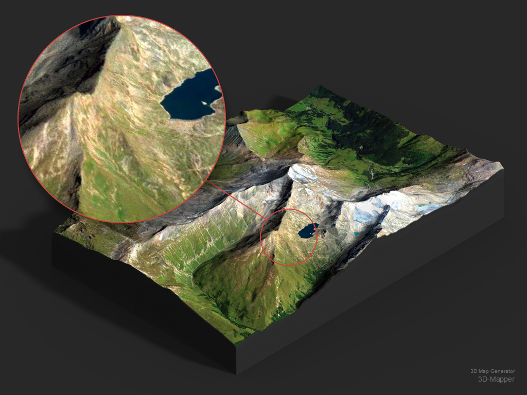
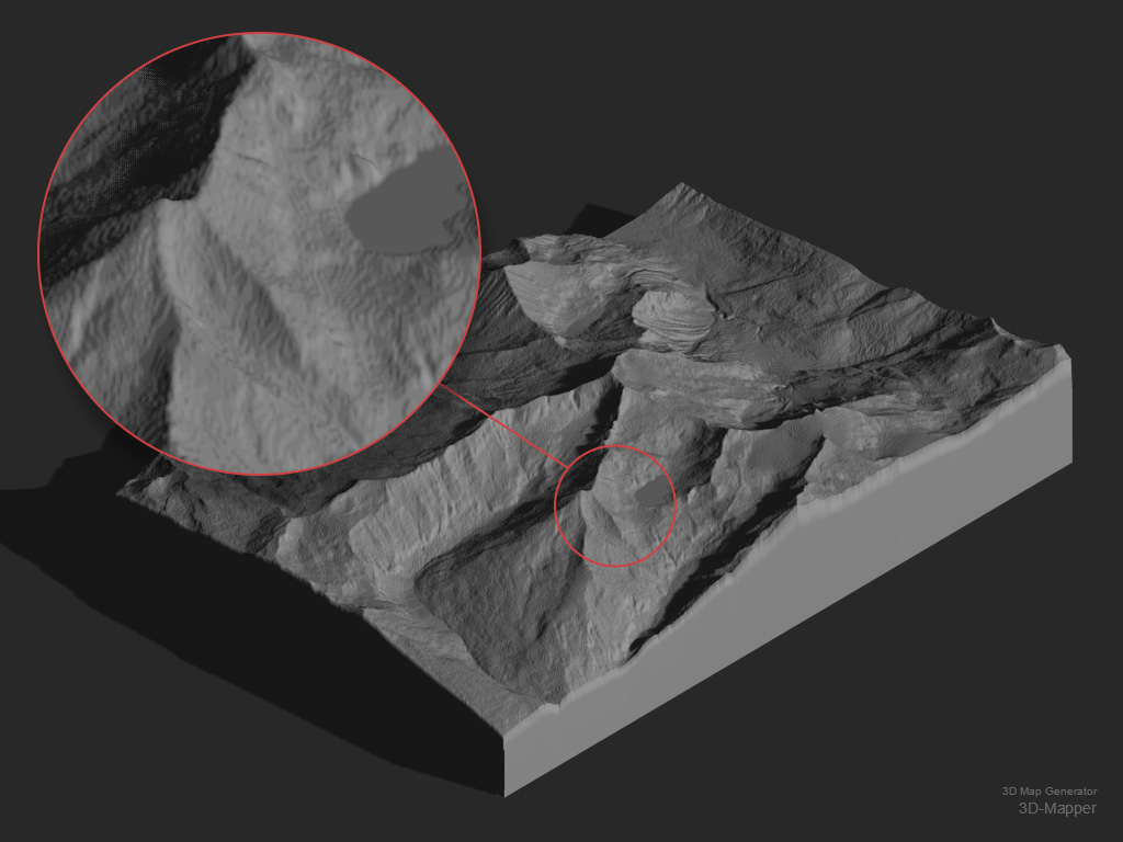
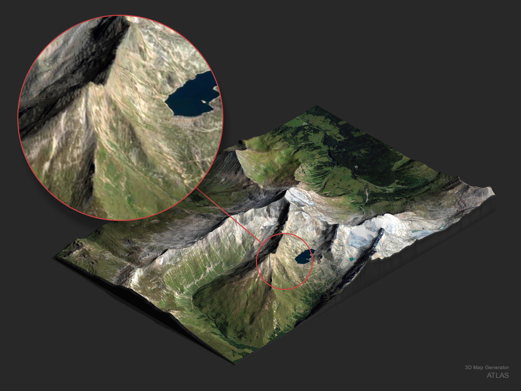
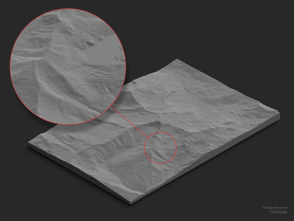
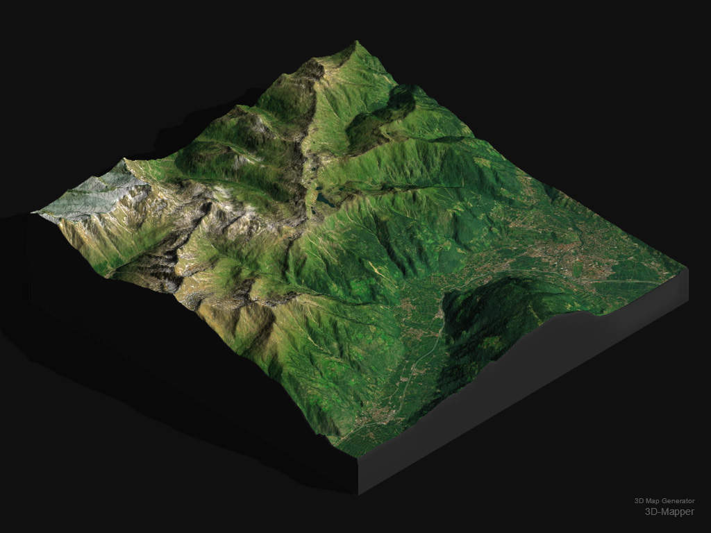
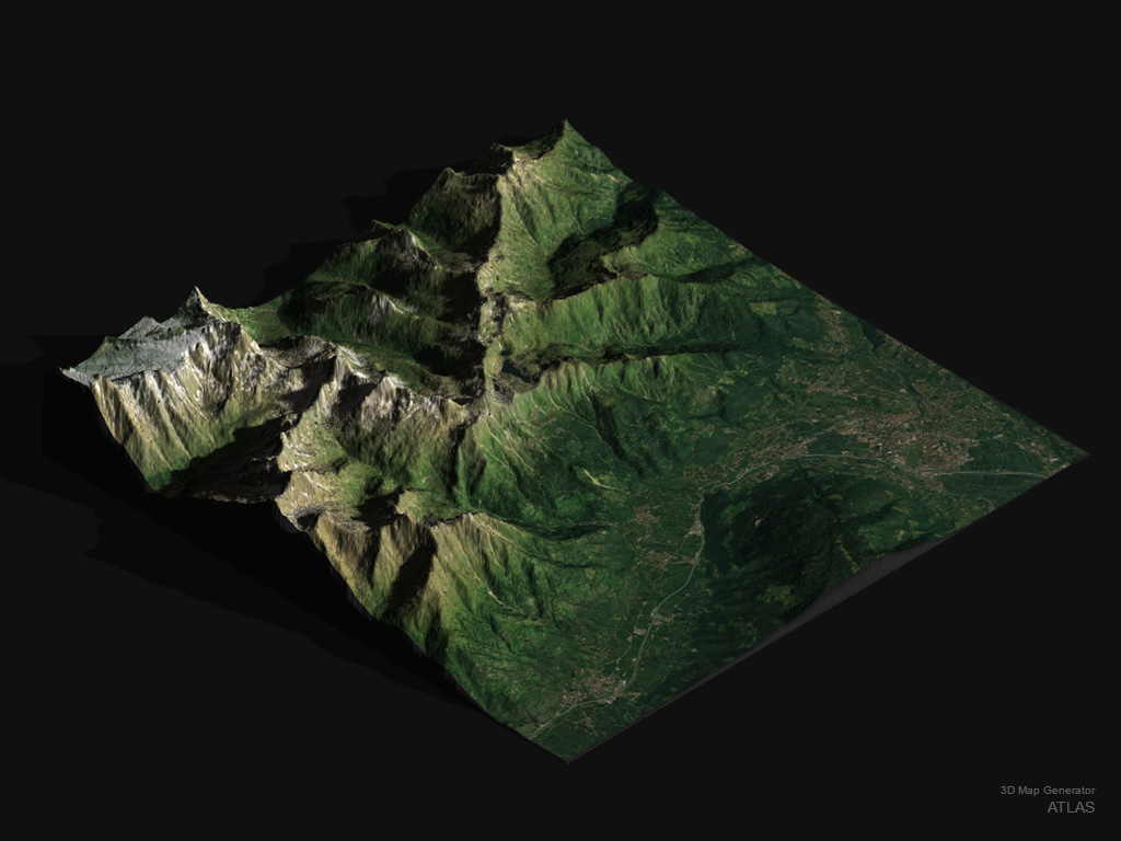
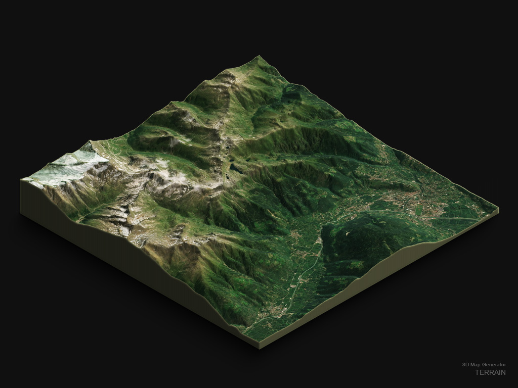
3D model or image of a 3D map
3D-Mapper and ATLAS
The generated result of a heightmap in 3D-Mapper and ATLAS is a real 3D model. This 3D model is editable in height and size at any time. Height, size and position of the map are independent and unlimited. The map can be rotated in any position and you are able to edit the surface texture and the light at any time. The 3D map is printable. With 3D-Mapper you can render it directly in Photoshop.
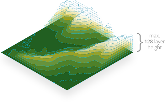
TERRAIN
The generated result of a heightmap in TERRAIN is an image of a 3D map. It consists of max. 128 stacked layers. That’s why the height of the 3D map is limited to 128 px. Before starting to generate, you need to determine one of the three isometric orientations and one of the five scale factors. The surface texture and the light can be edited at any time. The map is not printable in 3D.
Comparison of results
3D maps of the same tileset (3320 x 2282 px heightmap + texture)
Photoshop CC 2021, PC
Processing Time
3D maps of the same tileset (1200 x 1200 px heightmap + texture),
Adobe Photoshop CC-2021, PC, Intel Core i7 – 6700K CPU, 16 GB RAM