What’s the difference?
Which generator is the right one for me? To answer this question we gathered the most important differences and features here.
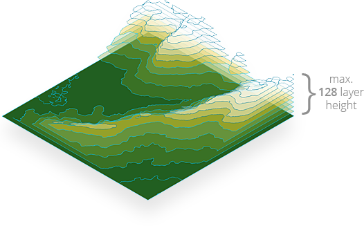
3D model or image of a 3D map
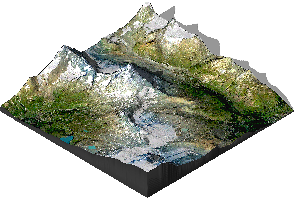
ATLAS
The generated result from a heightmap in ATLAS is a real 3D model. This 3D model is editable in height and size at any time. Height, size and position of the map are independent and unlimited. It can be rotated in any position. As presets there are 8 different orientations available. The surface texture and the light can be edited at any time. The 3D map is printable.

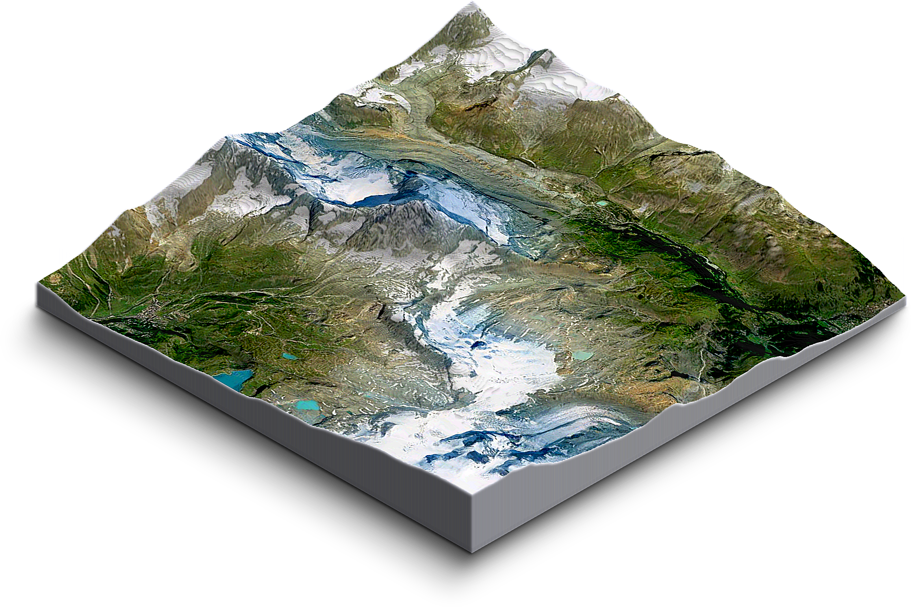
TERRAIN
The generated result from a heightmap in TERRAIN is an image of a 3D map. It consists of max. 128 stacked layers. That’s why the height of the 3D map is limited to 128 px. Before starting to generate, it must be determined in which of the 3 isometric orientations the result should be and which of the 5 different scale factors it should have. The surface texture and the light can be edited at any time. The map is not printable in 3D.
Compatible with Adobe Photoshop version

ATLAS

at least CC-2015.5 or
CC-2017, CC-2018, CC-2019 and newer
TERRAIN

at least CC-2014 or
CC-2015, CC-2015.5, CC-2017, CC-2018, CC-2019 and newer
Processing Time
ATLAS
3D map example of a 1200 x 1200 px heightmap with texture,
Adobe Photoshop CC-2018,
PC, Intel Core i7 – 6700K CPU, 16 GB RAM

Processing Time:
0:33 min
TERRAIN
3D map example of a 1200 x 1200 px heightmap with texture,
Adobe Photoshop CC-2018,
PC, Intel Core i7 – 6700K CPU, 16 GB RAM
Processing Time:
3:38 min
Save and Export
ATLAS
The 3D model can be exportes as
Collada (*.dae), Wavefront (*.obj), STL, U3D and others
The entire scene with the 3D map can of course also be saved in all common Photoshop file formats such as PSD, TIFF, PNG, PDF, JPG, GIF and others
TERRAIN
The image of the 3D map can be saved in all common Photoshop file formats such as PSD, TIFF, PNG, PDF, JPG, GIF and others. The 3D map can not be exported as a 3D file format.
Minimum system requirements
ATLAS
PC or MAC
- Multicore Intel processor with 64-bit support
- Mac OS X v10.9 (64-bit) or v10.10 (64-bit)
- Intel® Core 2 or AMD Athlon® 64 processor; 2 GHz or faster processor
- Microsoft Windows 7 with Service Pack 1 or Windows 8.1
- 2 GB of RAM (8 GB recommended)
- OpenGL-enabled graphics card
![]()
- min. Photoshop CC.2015.5 or newer (CC-2018 recommended)
- English Photoshop version (Every language can easily be changed to English and vice versa)
TERRAIN
PC and MAC
- Multicore Intel processor with 64-bit support
- Mac OS X v10.9 (64-bit) or v10.10 (64-bit)
- Intel® Core 2 or AMD Athlon® 64 processor; 2 GHz or faster processor
- Microsoft Windows 7 with Service Pack 1 or Windows 8.1
- 2 GB of RAM (8 GB recommended)
- min. Photoshop CC-2014 or newer
Product Comparison
This list only shows those features that are missing in at least one version.