Heightmap Design Tools
Create your own Heightmap
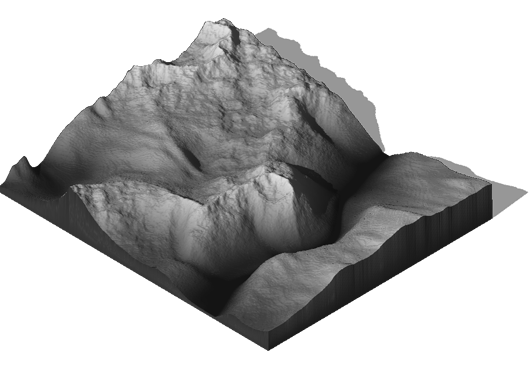
To create a terrain with the 3D Map Generator a grayscale heightmap is required. That can be an existing height map from outside sources, a heightmap created with the plugin or real world locations from the online Heightmap Browser.
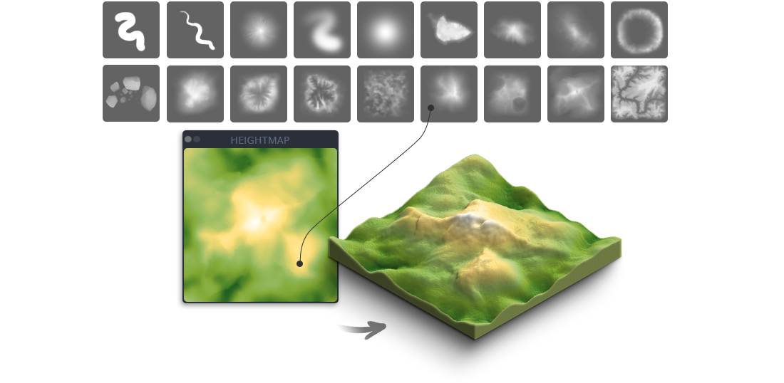
For creating your own heightmap there are extensive tools available in the panel. With Auto-Heightmaps you can generate random heightmaps that can be edited further for example by using the 60+ heightmap brushes. Therefor the Height Color tool could be very helpful to follow defined heights.
Basic Brushes
With the Basic Brushes you can create simple map surfaces.
The Texture Brushes ar for stamping different mountains and canyons.
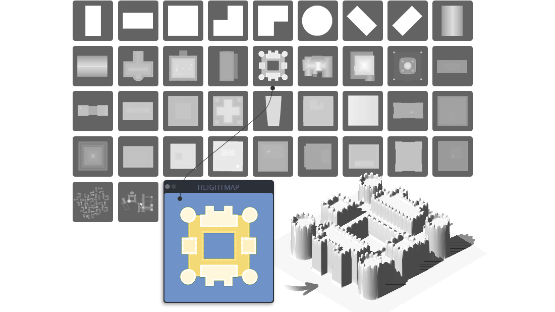
Buildings Brushes
With the aid of the different Building Brushes you can stamp symbolic cities onto your heightmap. Even extensive street maps are possible.
Auto-Heightmaps Tool
If you want to create your own heightmap, the presets of the Auto-Heightmap generator are good basics. With the new Auto-Heightmaps feature there are 7 different One-Click random heightmap styles available that create for you automatically. You can take it as it is or use it as a good starting point for your own heightmap drawing. Auto-heightmaps can be easily combined or painted over.


Add-Level feature
It can be quite challenging to draw a simple flat area into a heightmap (e.g. waters or building areas). With the Add-Level feature this is done with just one click.
Grayscale Color Tool
A heightmap consists of grayscales between 0 (black) and 255 (white). With this tool it is easy to select the different grayscales. Additionally you can enter the highest point of your map into the text field on the right side. The tool then calculates which grayscale relates to which height. The value appears above the blue slider. That will help you to generate more accurate terrains. (A) names the reference value that defines the highest point of the map. 500 is set by default. (B) names the middle of the grayscale. So if for instance (A) is 2686, (B) would be 1343.

What is a Heightmap
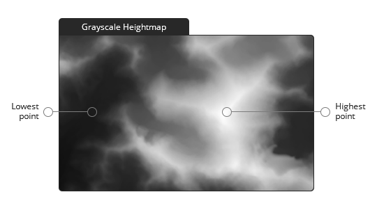
A heightmap or heightfield is a raster image used to store values (such as surface elevation data) for displaying in 3D computer graphics.
A heightmap contains one channel, interpreted as a distance of displacement or “height” from the “floor” of a surface and sometimes visualized as luma of a grayscale image, with black representing minimum height and white representing maximum height.