CREATE YOUR OWN 3D MAP IN PHOTOSHOP
3D-MAPPER
CREATE YOUR OWN 3D MAP IN PHOTOSHOP
3D-MAPPER


Find almost any place on earth right in Photoshop. Choose from different textures.

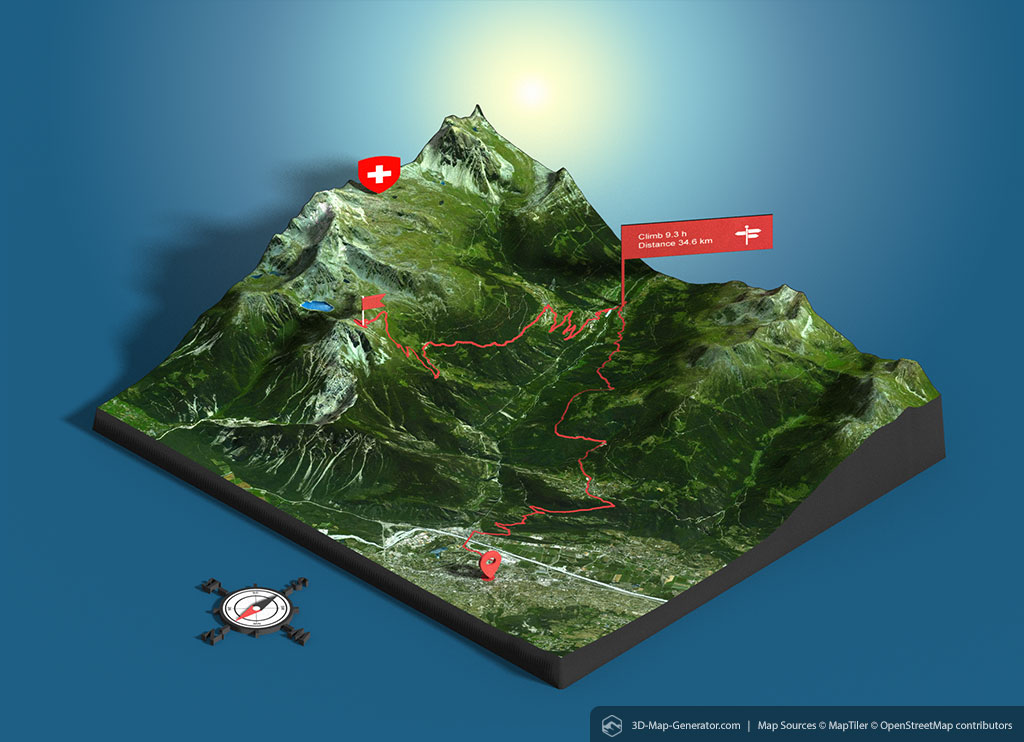
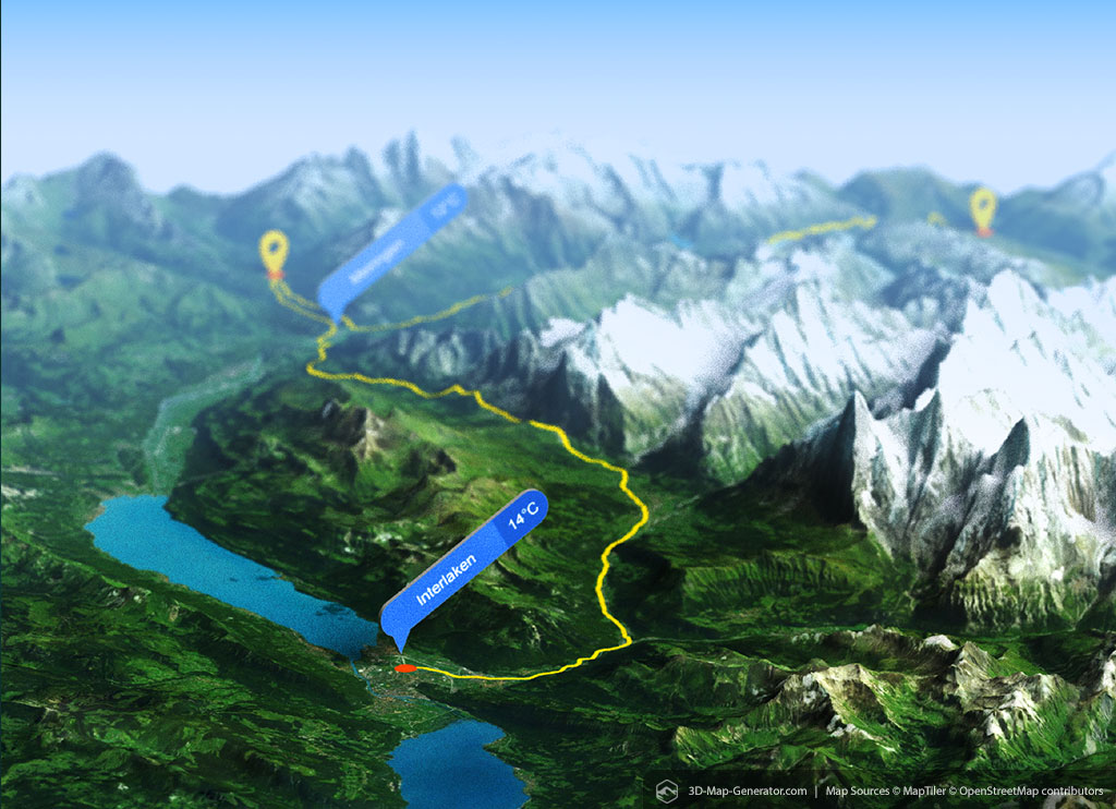
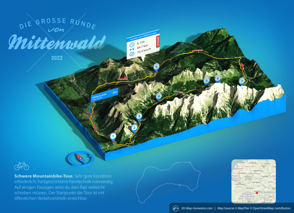
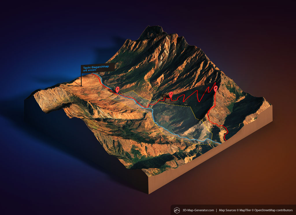
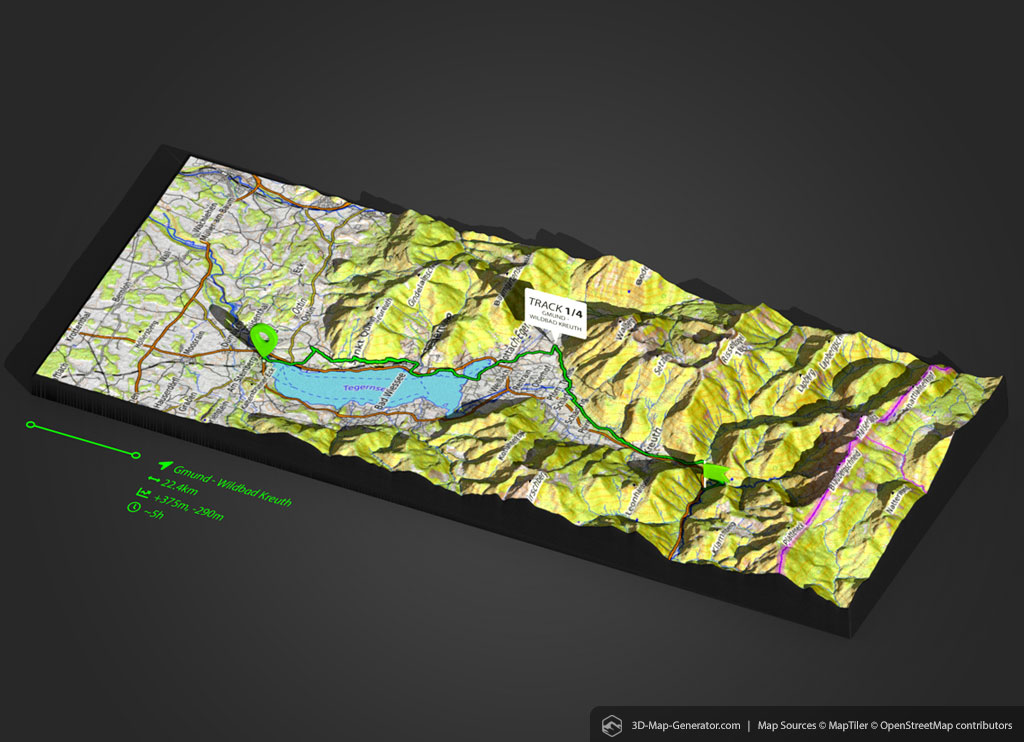
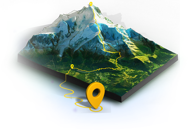
Import your GPX track directly into Photoshop and generate a 3D map including a route.

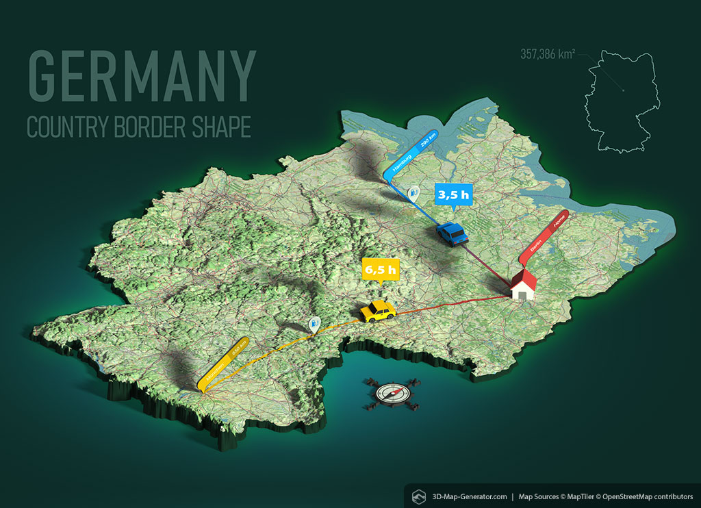
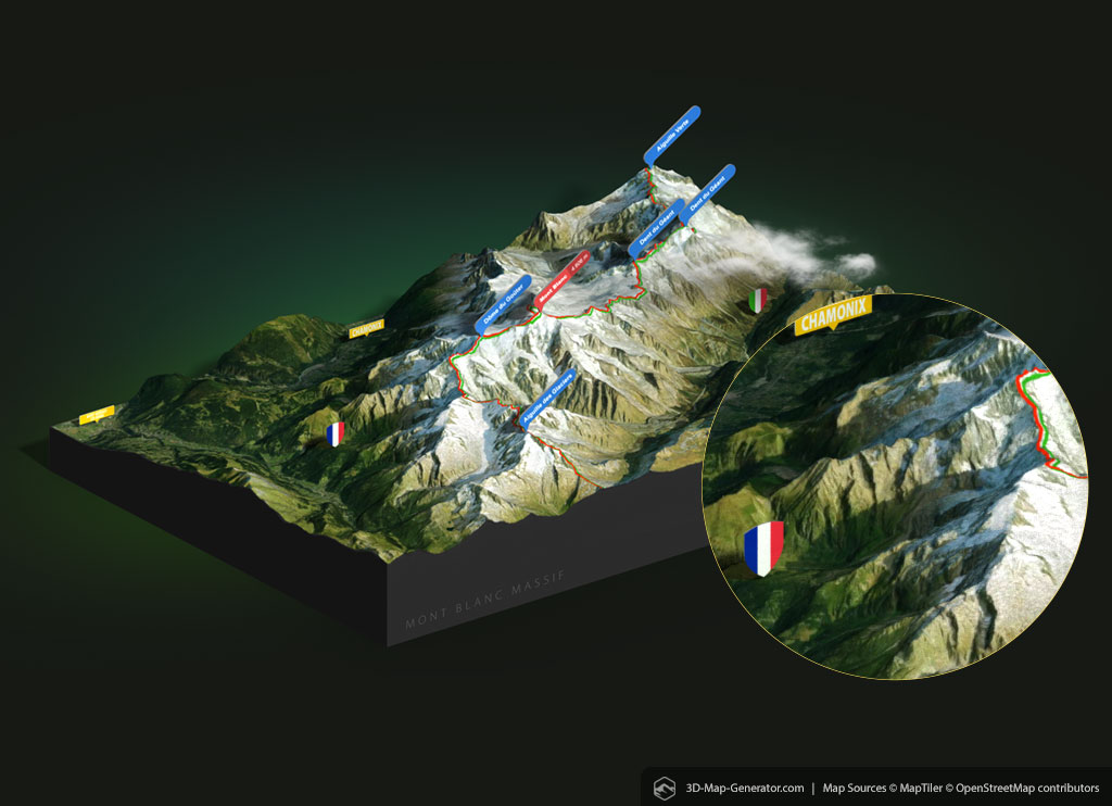
Define position, rotation, texture, light and size of the map scene.

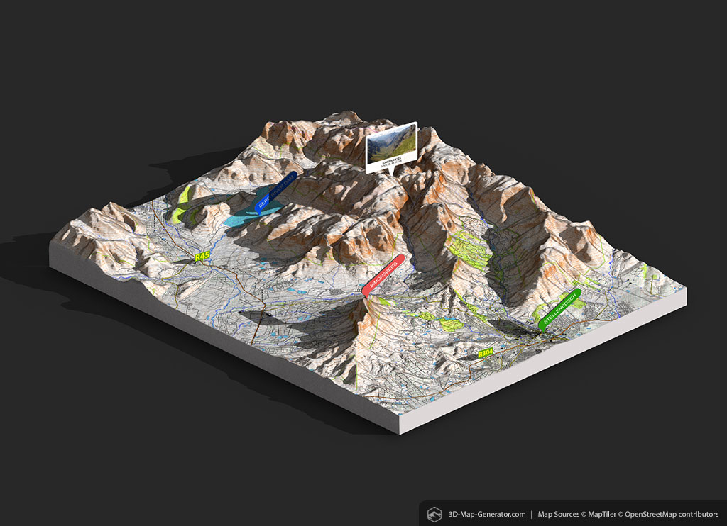
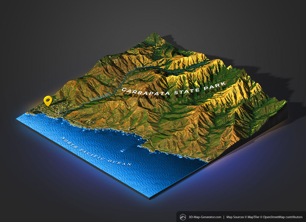
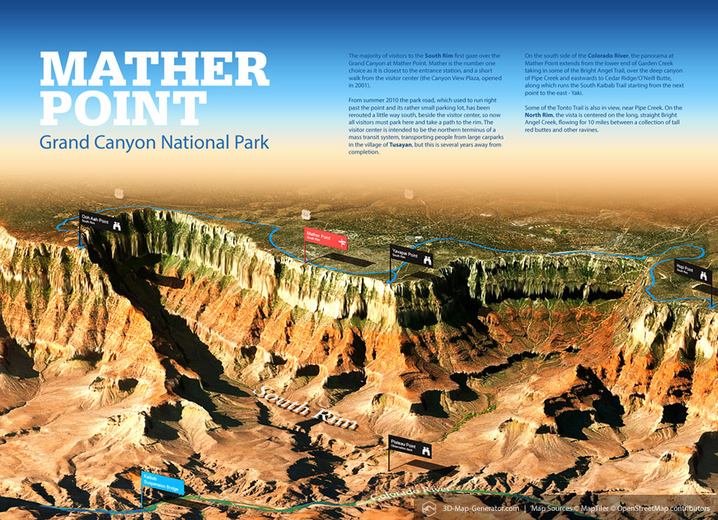
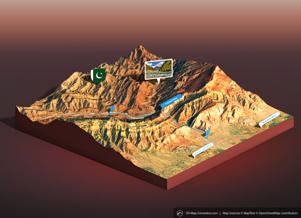
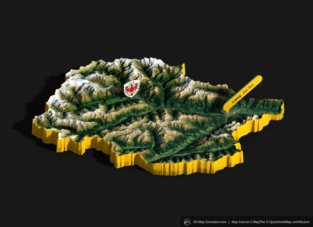
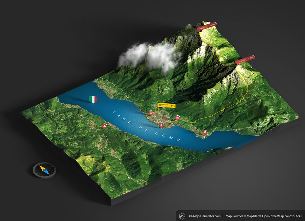
Place various 3D elements like pointers, pins, flags and info cards on your 3D map.
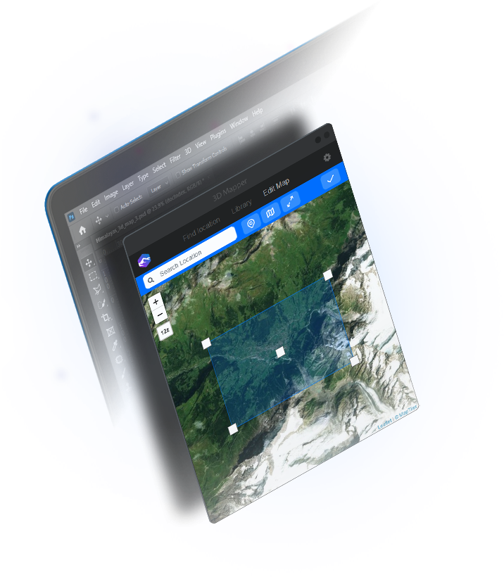
With the integrated Location Browser it is possible to find and download map areas from almost every place on earth directly in Photoshop. The Location Browser has its own search function, but you can also use coordinates or Google Map URL. Additionally there is a GPX file upload available to create maps with a track on it.
You can also choose between different map textures (OpenStreetMap, OpenTopoMap, Satellite) and map set sizes (1024px up to 3072px at 96 dpi). The sizes available depend on the zoom level and the selected tile set.
Search and create real 3D maps of almost every place on earth directly in Photoshop or upload your own GPX files. Use different map modes and be creative in customizing your 3D map. Various 3D elements turn the map into an informative and impressive eye-catcher. Render the final 3D map right in Photoshop and choose between different export formats to publish, share and even print your map. You need a legal commercial use? No worries, we have a solution for that too.

A GPX file is a GPS data file saved in the GPS exchange format. It contains longitude and latitude location data that may include waypoints, routes, and tracks.
3D Mapper allows you to upload GPX files directly into Photoshop and to create 3D maps with real tracks on it.

With simple plug-in control elements the generated 3D map can be easily scaled an rotated. These control elements only affect the 3D map, not the scene.
Work faster with useful shortcuts:
Watch the teaser video to see how it works
Try our 3D mapper online tool.
No additional software is required to create and
download your custom 3D map!
With the 3D Map Generator plugin for Photoshop it is dead easy to generate professional 3D maps of almost every place on earth. Each generated 3D map can be easily adjusted and modified, rendered and printed, shared on the internet, 3D printed or further processed as a 3D file in other programs. See what’s possible:
Our plugins are made in such a way that anyone can achieve a professional result in just a few steps without any specialist knowledge. If you are able to open Photoshop, you will also be able to create a 3D map! With each product there also come dozens of tutorial videos and instruction PDFs. Should there still be any questions left unanswered, you can of course contact our e-mail support.
![]()
![]()
![]()
![]()
3D maps can be used for many different needs: show your place of residence, your location or home country or visualise your last vacation trip. Print a poster of an interesting geographical area – for your own room or as a birthday present. Use 3D maps as educational material and teach your students geographical correlations, extraordinary terrain or the cycle of nature. Create captivating presentations with impressive infographics. Explain routes and paths for hikers, climbers and mountain bikers. Picture maps of holiday destinations and points of interest (POI). Print out the Grand Canyon in 3D or just explore mountains and valleys you’ve never been to before. 3D map your ideas!
Example of use: infographic, presentation, websites and blogs, visitor maps, navigation, complex geographic illustrations, teaching material, weather maps, tourist guide, 3d print model, 3d photo, travel report, travel pages, route visualization, illustrations
No Photoshop? No Problem: 3D-Mapper is also available as an online service! The finished 3D maps can be downloaded as 3D files, as snapshots or for embedding on a website. There are also high-res source images (heightmap and different surface textures) available for download. Find more options on the website:
Meanwhile, the 3D Map Generator is a more than 10 years lasting evolution of learning, trial and error and development. When we published our first 3D Map Generator as a Photoshop action in 2011, the result was a shape that could be moved in just three isometric positions and hundreds of additional icons were available to design the map.
With GEO, selected areas on the map now could grow upwards for the first time. After that, TERRAIN was the first map generator that used heightmaps – elevation data from real locations – and was thus able to picture geographical conditions in a realistic way. Just the result was no real 3D map but still an image of a 3D map (2.5D map).
Finally, ATLAS made this last step in the development of the 3D Map Generator and was the one that could create real 3D maps from heightmap data. The only restrictions were the usage of Google map images and the map size limitation.
For the map surface ATLAS used Google satellite images. No problem for personal use. But unfortunately Google data may not be used for commercial projects. Additionally the map size depended on the user’s screen resolution, because the map texture had to be saved as a screenshot.
With the new plugin even these problems are solved. 3D-Mapper uses the marvelous satellite imagery from MapTiler as well as the open source data from OpenStreetMap. The data can be downloaded in high resolution and, if needed, used commercially by purchasing a license. The integrated location browser makes it easy to search for any desired location – the same way you use Google Maps search. In addition, places can also be found using coordinate information such as latitude and longitude. You can even use a simple Google Maps link for your search or import your own GPS data (as GPX file).